24 February 2023
If a citizen of Padua from the early 20th century were to take part today in the Padova Water Marathon and look around, they would rightly ask: “Am I still in Padua?”
Let’s try to show the most curious PWM canoeists, with the help of historical photos from the early 1900s compared with today’s images, what life in Padua was like just over a century ago, how it has been transformed, and how it is still changing—so much so that the question above becomes entirely understandable.
The city—the urban structure enclosed within the 16th-century walls and bordered by the Bacchiglione—changed profoundly during the first 50 years of the 20th century. We do not aim to summarize decades of urban transformation in just a few lines; three examples, with “before and after” images, are enough to illustrate a true “genetic” transformation.
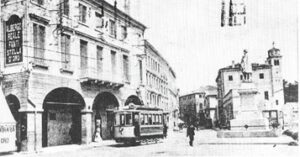
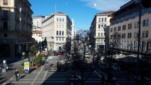
Let’s begin with the construction of the “Rettifilo,” a new road over 1 km long, built at the beginning of the 20th century to connect Piazza Garibaldi, the city center, with the railway station, which had been built a few years earlier outside the walls.
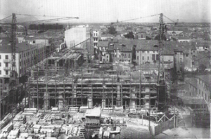
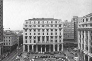
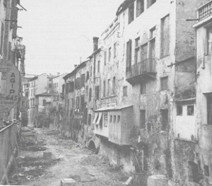
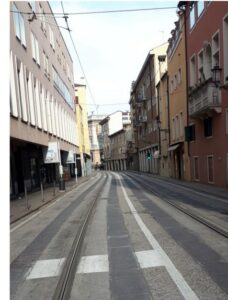
The second major transformation took place in the 1920s and 1930s, with the demolition of entire medieval districts—Santa Lucia and the Ghetto (later preserved)—involving the expropriation of more than 2,000 homes, described at the time in harsh terms as indecent, unsanitary, and degraded areas. These were replaced by the new “central districts,” with wide streets and squares and monumental buildings that are still the subject of lively urban debate today.
The third phase came in the 1950s and 1960s with the “covering of the canals,” aimed at opening new roads and solving the growing traffic congestion in the city center.
These interventions—unthinkable today—together with the rapid construction of new neighborhoods around the 16th-century Venetian walls, where once there were fields and gardens, especially after World War I when Padua became a military command center, completely reshaped the city’s appearance.
Patavium was founded on a bend of the Medoacus; for over 2,000 years, water—rivers and canals—was the main source of life, transport, and communication. The Bacchiglione and its connected waterways powered mills, sawmills, blacksmiths’ hammers, and fulling mills. In a way, water once did what electricity does today.
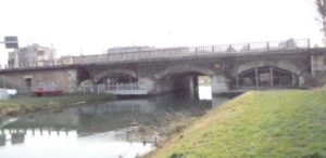
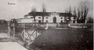
From the start of the Marathon at Canottieri to Bassanello, there are no major urban changes—just a few additional bridges for cars and trains crossing the river. It is from Bassanello onward that we encounter the first major structural modifications, starting with the construction of the Ponte dei Cavalli (or Sostegno), which regulates the flow of the Bacchiglione, historically responsible for repeated and devastating floods.
After studies lasting over a century, part of the river’s flow was diverted to the right into the new Scaricatore Canal. The 1875 bridge originally included a hydraulic control building; in 1964 it was significantly modified to widen the roadway, close two lateral arches, and leave only a central movable gate for water regulation.
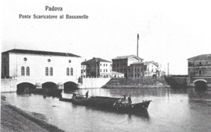
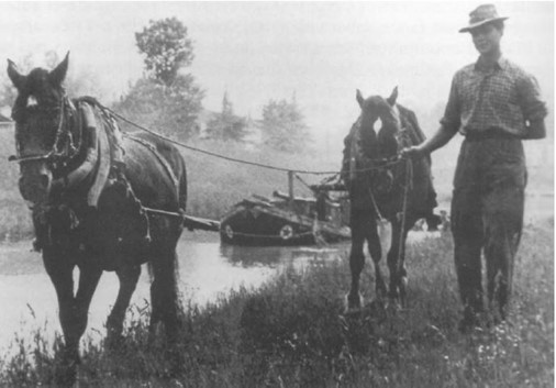
In medieval times, a floating bridge existed here. The name derives from the practice of towing barges with horses along the towpaths.
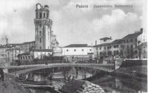
Following the marathon route, we stay to the left, pass under the low arch of the new bridge, and enter the city, reaching the second bridge—the Specola bridge, built in iron in 1880, one of the few metal bridges. At that time, the bridge and road were used to unload goods—fruit, vegetables, wine, building materials—from barges arriving from the Euganean Hills along the Battaglia canal.
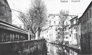
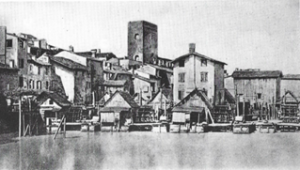
We continue paddling under many Roman and medieval bridges until we reach Ponte Molino—“the mill bridge”—so named because downstream of this five-arched Roman bridge there were once eighty mills, forming the industrial area of medieval Padua, famous for wool processing from the nearby Altopiano dei Sette Comuni.
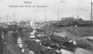
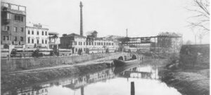
A few more strokes and we glide onto the Piovego Canal, dug in the early 1200s to connect Padua quickly with Venice, running alongside the Renaissance walls. We pass under Ponte del Popolo (1908), built to link the city center with the station, and observe on our left the area where the first industrial zone of Padua developed in the early 20th century.
This stretch of the Piovego—just over 500 meters between Ponte del Popolo and Ponte Omizzolo—was where wooden barges once arrived carrying heavy loads of coal from Marghera, Venice’s commercial port, to supply the city’s gas production plant.
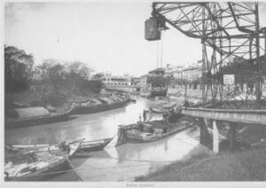
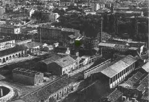
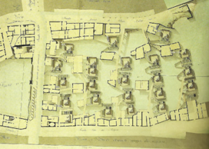
Further upstream, the left bank of the Piovego was adapted as a masonry dock as early as 1881, complete with a steep ramp and a manually operated crane for loading and unloading goods along what had become the main commercial artery between Padua and Venice.
Paradoxically, while the left bank was an industrial hub, the right bank was transformed by the municipality into leisure areas. The Venetian walls, acquired in 1982, were lowered, and pedestrian avenues and gardens were created up to the Scrovegni Chapel.
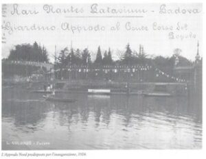
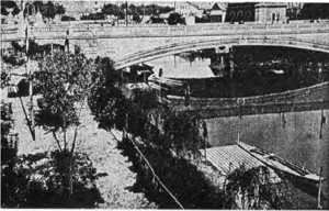
Soon after, the floodplain became the base for the Rari Nantes rowing club, whose main headquarters were located further south along the Bacchiglione.
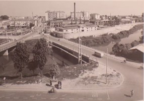
The city continued to evolve. The gas plant was closed in the early 1950s and replaced by a bus terminal. Metal railway bridges from the early 1900s were rebuilt in reinforced concrete to accommodate increasing road traffic. The public slaughterhouse, once built along the canal for water use, was decommissioned and later converted into a warehouse and, more recently, an office building.
Through historical images, we have seen the transformation of a large area of the city along the Piovego—from an industrial and commercial hub driven by river transport to a completely different urban landscape
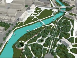
Today, this area is undergoing yet another transformation with the creation of the new Boschetti Urban Park, designed by architect Lorenzo Attolico. This forward-looking project is reshaping the city, restoring and reorganizing a part of the territory that has changed dramatically in a relatively short time.
It is a sign that the desire to live in more nature-friendly environments is growing stronger. It is also a sign that the era of unchecked real estate speculation may finally be coming to an end—hopefully for good.