
18 December 2024
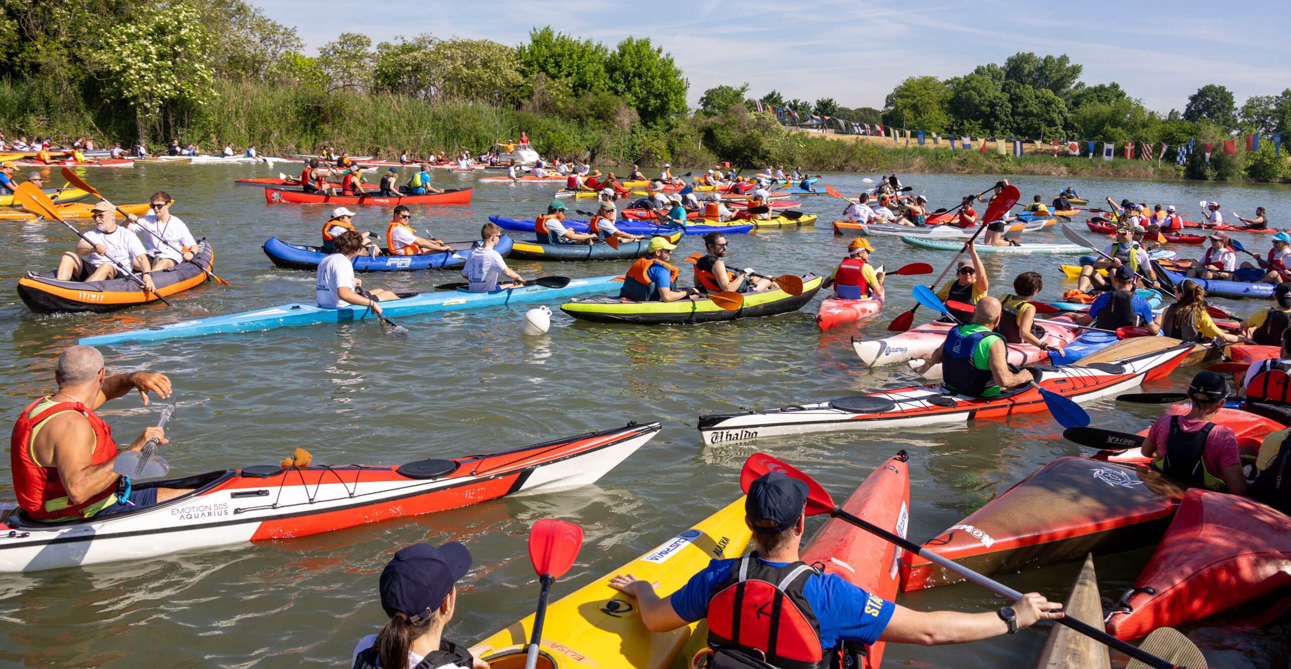
Participants in the Padova Water Marathon will be surprised to discover how many bridges they will pass beneath during the long route around Padua’s river ring. These bridges belong to very different historical periods and construction styles, built over more than 2,000 years of the city’s history. The bridges described below will be encountered by the many paddlers of the P.W.M.
At its peak, the city counted as many as 65 bridges; 16 of them were buried in recent times and another 6 were demolished. In ancient times Padua was surrounded by two rivers, the Medoacus (now the Brenta) and the Retrone (now the Bacchiglione), which physically marked the boundaries of the city.
Around 100 A.D., Patavium was the most important commercial center in northeastern Italy thanks to its transport network, which relied almost entirely on rivers and canals, the safest and fastest communication routes of the time. During the Roman era at least eight city bridges were built along the Medoacus, the flumen oppidi medium remembered by Livy. Today four remain in use, two were buried in the second half of the twentieth century, and two were demolished.
 The river was a fundamental element of urban and economic life. In the central area, near the present University headquarters, there was what today would be called a canal port. Along the stone quays docked pirogues and rafts transporting and trading salt, fish and vegetables from the lagoon (Venice did not yet exist). Valuable stone materials arrived from the Euganean Hills, while timber and wool were supplied from the nearby Asiago plateau.
In the following centuries this commercial wealth declined due to the fall of the Roman Empire, the devastating breaking of the Adige River in 589, which reshaped the hydrography of the Venetian plain, and the invasion of barbarian populations that destroyed the city in 602. For the next four centuries Padua virtually disappeared from historical records.

During the communal period, around the end of the 12th century, Padua once again became a centre of political power and economic activity; in the 13th century several canals were excavated: the Fiumicello (inner Naviglio), the Carmini and San Leonardo canals, the Santa Sofia canal, Santa Chiara, San Massimo, Alicorno and the Acquette canals. The names themselves already indicate that these were internal canals mainly used to irrigate large monastic gardens, clearly visible in the numerous green plots shown in seventeenth-century maps, and to power many mills used for wool processing, the city’s main industry.
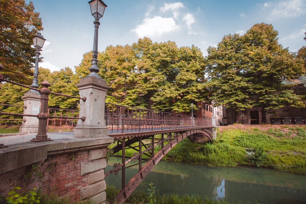
All these waterways are crossed by numerous small bridges, usually single-arched structures built using squared stone blocks and bricks; many of these are still in use today. Some, located along the city walls, were equipped with movable grates and served as customs barriers.
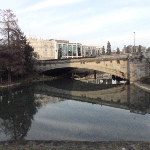
 Ponte di Sant’Agostino was originally built in wood in 1374 and was later rebuilt in stone and restored in 1552, as recorded by the plaque placed on the upstream parapet of the single span crossing the Tronco Maestro canal. It was lowered in 1792. The bridge connects Via San Tommaso with Riviera Paleocapa and takes its name from the nearby Basilica and Convent of Sant’Agostino, demolished in 1818 to make room for the Piave barracks. Upstream of the river lies the Sant’Agostino weir, built to provide a constant flow of water to the Torricelle canal.
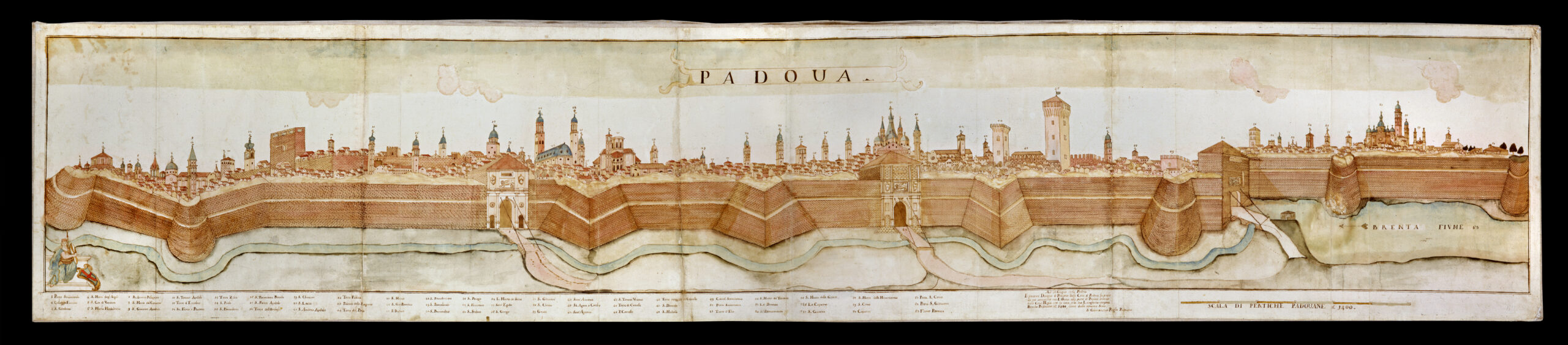
The excavation of the Battaglia Canal in 1201, which connected the city with the Euganean Hills, and the shortly following construction of the Piovego Canal, linking Padua to Venice along the Brenta River, brought about a new period of prosperity for the city, reaching its peak during the long rule of the Carraresi, which ended in 1405 when Padua surrendered to Venice. As the years passed, at the beginning of the sixteenth century the Venetian Republic decided to fortify the city by building, over approximately fifty years, an imposing defensive wall 11 kilometres long, interrupted by only a few gates protected by a canal and surrounded by a vast uninhabited open area free from buildings, more than one kilometre deep, known as the “guasto”. P.W.M. participants will paddle for a long stretch of the course along this river ring at the foot of the walls, passing beneath the bridges built at the city gates.
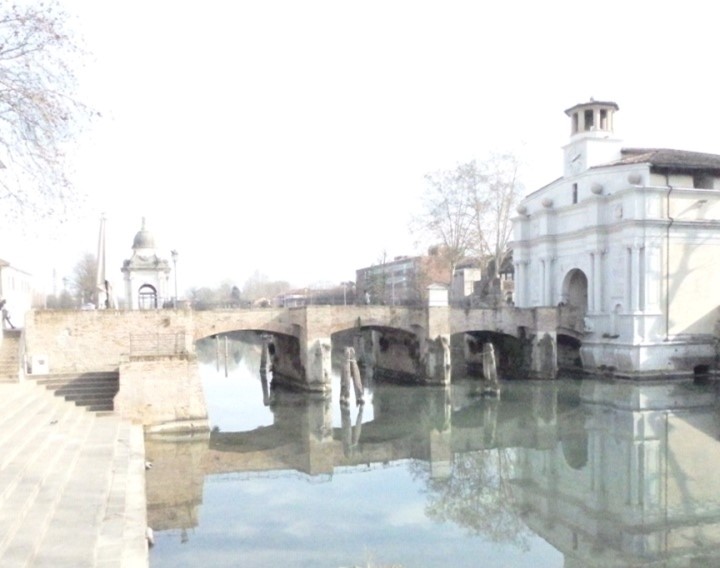
One of the most evocative gates of the city walls is Porta Portello, the city port from which all the cargo boats (“burchi”) and the elegant passenger boats (“burchielli”) carrying Venetian nobles to Venice departed and arrived.
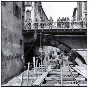
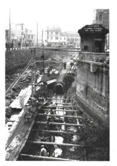
 From that time on, for about four centuries until the early 1900s, Padua preserved the same urban dimensions as depicted in numerous engravings of the period, such as the one from 1809. It was after the First World War that major urban developments took place both inside and outside the city, including the construction of the road connecting the city centre to the new railway station in the early twentieth century, the demolition of the entire Santa Lucia district between the 1930s and 1940s, and the covering and burial of the main canals that crossed the city during the 1950s and 1960s. These urban planning decisions, difficult to understand today, profoundly changed the appearance of the city.
Ponte del Popolo was inaugurated in 1908 to complete the long avenue built in 1905 connecting Piazza Garibaldi with Padua Railway Station. Designed by engineer Alessandro Peretti of the Municipality of Padua, it features a single flattened arch, the first example of its kind among reinforced concrete bridges, clad in trachyte and equipped with platforms and pedestals at both ends. It crosses the Scaricatore canal, excavated in 1209 to connect Padua with Venice.
New districts developed outside the city walls, new connecting roads were built linking the surrounding towns, along with new reinforced concrete road bridges both inside and outside the city, as well as railway bridges with iron spans.
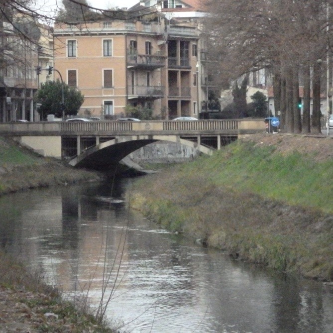
Ponte San Benedetto, built in reinforced concrete in 1952 with a single arch over the Tronco Maestro canal, connects two sections of Corso Milano. It takes its name from the nearby Church and Monastery of San Benedetto Vecchio in Riviera San Benedetto.
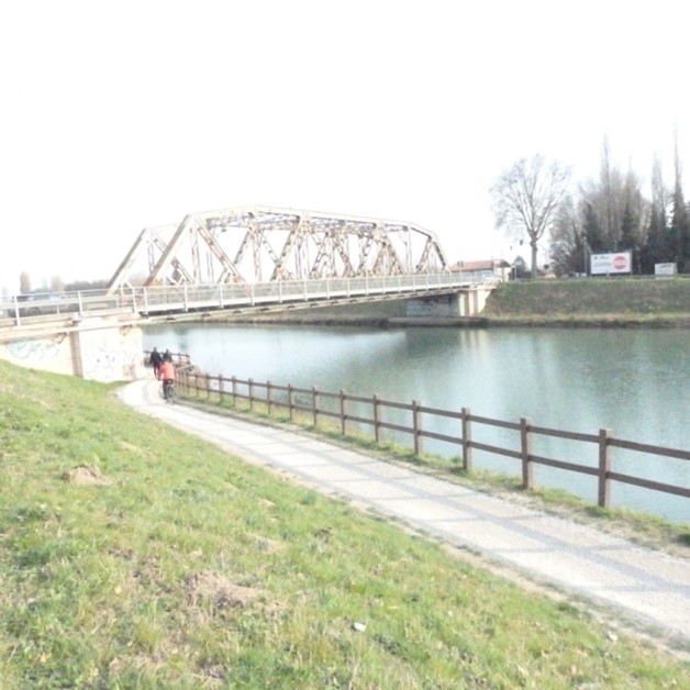
The Voltabarozzo metal bridge originally served both road and railway functions, allowing the local train connecting Padua and Venice to pass along the Riviera.
After decades of studies and planning, in the mid-1800s the Scaricatore canal was excavated south of Padua to divert the waters of the Bacchiglione outside the city, protecting it from destructive autumn floods. The work proved insufficient to prevent flooding in the inner districts and was expanded during the 1940s with the widening of the original canal and the construction of a second canal, the San Gregorio, which carries the river’s waters directly into the Brenta.
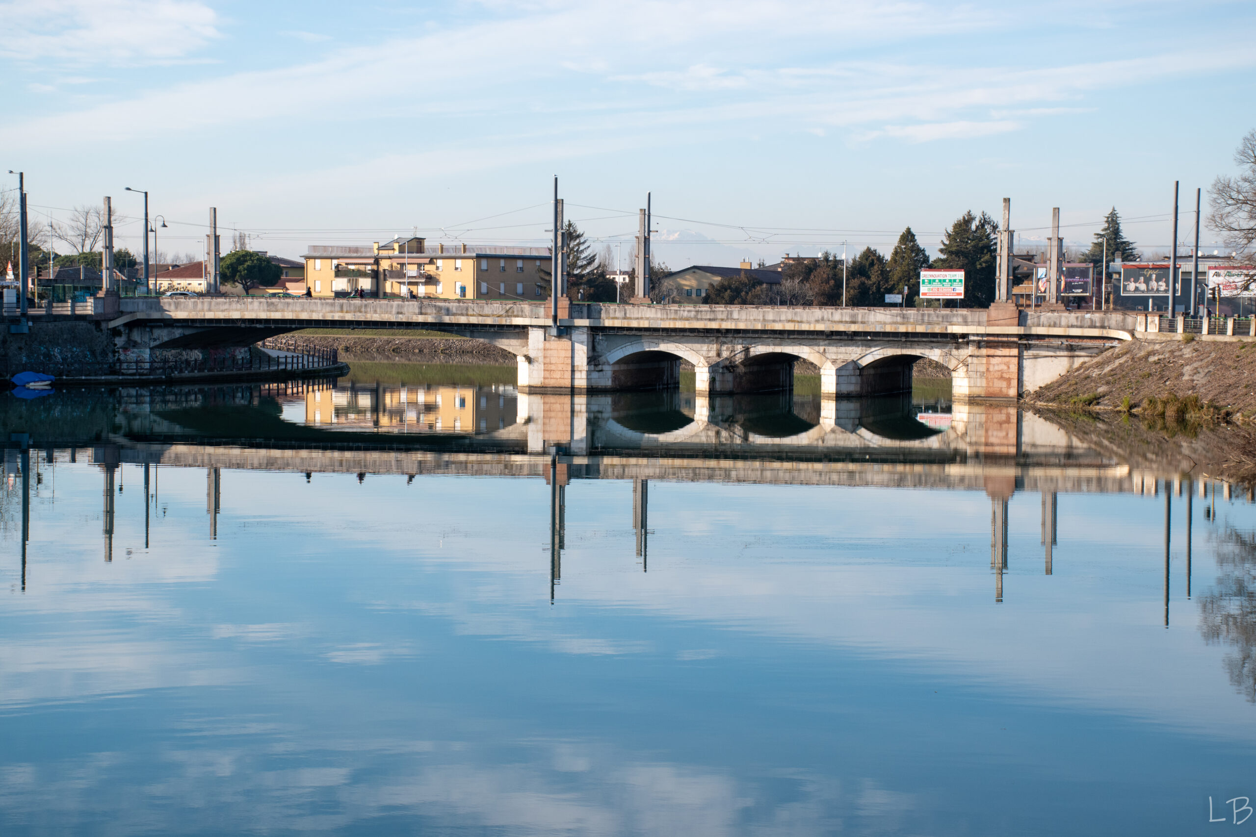
Ponte Scaricatore — built in several phases starting in the nineteenth century — has its first section on the left bank consisting of three small arches designed in 1864 by Count and engineer V. Fossombroni to regulate the waters of the Bacchiglione flowing into the Scaricatore canal excavated between 1850 and 1860. In 1913 the bridge was widened to allow smoother vehicular traffic. The second section consists of a single span built in the 1930s following the widening of the Scaricatore riverbed and the relocation of the hydraulic control works to Voltabarozzo. The bridge takes its name from the artificial canal used to discharge excess water during the recurring floods of the Bacchiglione. The canal, designed by engineer P. Paleocapa, professor of Hydraulics at the University of Padua, was excavated between 1850 and 1863; the intervention proved insufficient to protect the historic city centre from flooding, and in the 1920s the canal section was further enlarged.
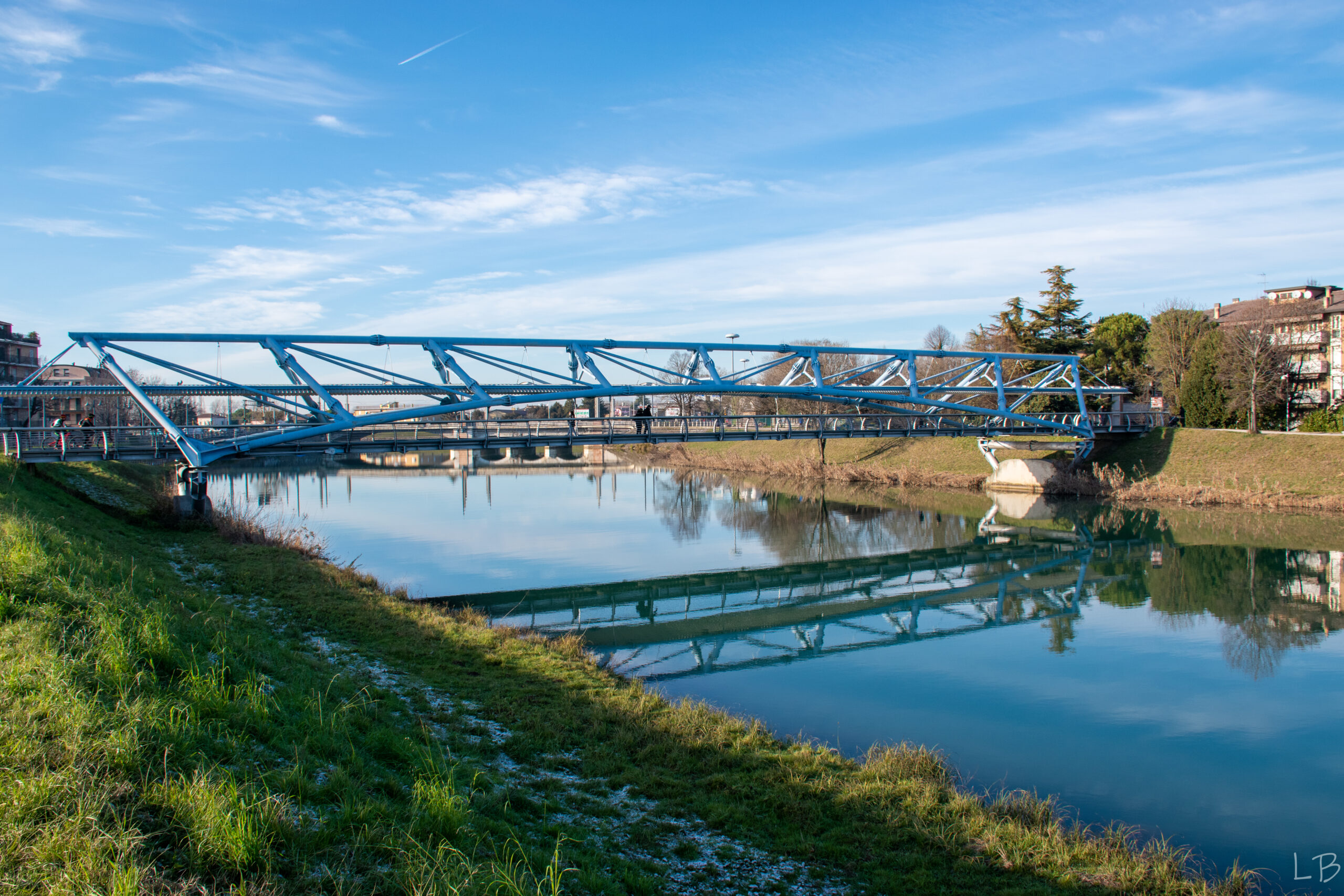
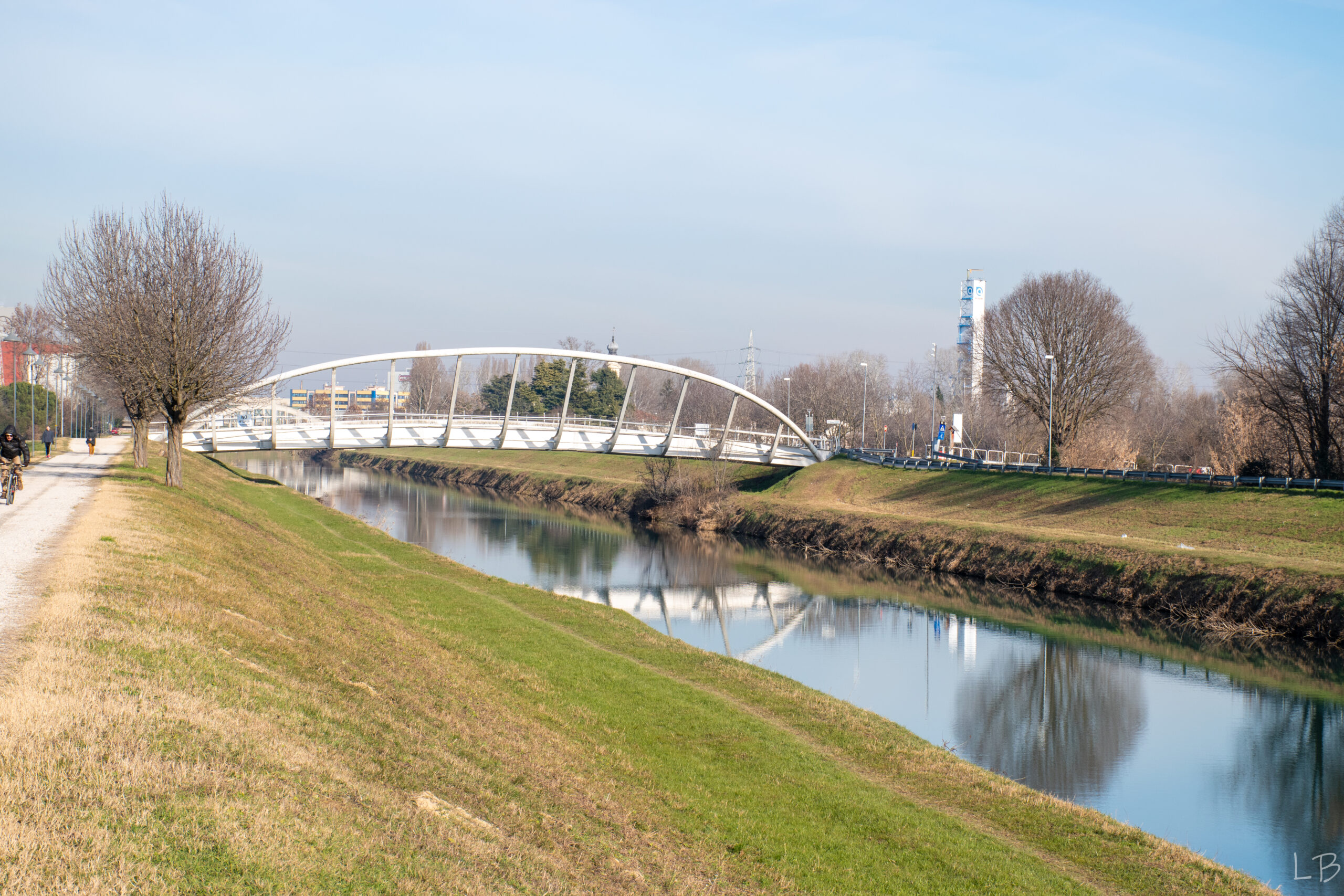
These two large canals, San Gregorio and Scaricatore, will be fully navigated by P.W.M. participants. Along these waterways, paddlers will admire the new metal walkways built to allow an ever-growing number of citizens to walk alongside these watercourses, which have been transformed into long green parks. These remarkable structures, installed from the year 2000 onwards, represent a revolutionary change in the mindset of Padua’s citizens, reconnecting neighbourhoods on a human scale rather than dividing them with large roads and ring roads increasingly congested with cars built in the late twentieth century. We will discuss this further in a future article.